Monday, February 25, 2013

Day 36 - Snowmass


Today’s hike:  Up Snowmass Mountain - Fanny Hill to Dawdler to Lunchline to Max Park to Trestle to Adams Avenue
Length:  5.5 miles
Elevation gain:  2,000’ (starting at 8,400’)
Thoughts:  Skiing these runs is a lot more fun, but if I can do 3 miles and 2,000’ uphill at this altitude, I’m ready.

With kitty’s needs fully attended to and NZ just a week away, I decided to take a day off from skiing to get my final training hike in.  Today was my chance to get the middle-distance hike focusing on elevation gain under my belt, and see what all this training over the past few weeks has done for me.  So where do you go when you are in ski country and looking for a good uphill hike?  Up the ski trails!  So I strapped a set of Yaktrax over my hiking boots and started climbing, taking care to stick to the groomed runs.  

Seeing a ski hill from this perspective is really interesting.  You quickly realize how steep some of the terrain really is - even the green/easiest runs.  It’s also interesting to observe how the skiers react to you.  Some were oblivious to me and cruised right by, leaving me in their ski wash.  Others stopped to ask about the hike, route me on, tell me they thought I was crazy, etc.  It was very entertaining.

Hiking on a ski area also gives you a fantastic perk - the chance for a hot lunch.  After I’d huffed and puffed my way up to 10,400’, I started back downhill to the closest on-mountain restaurant.  Here was my view from today’s lunch.  Not bad, huh?  :)


With my breath back and a full tummy, I headed back downhill to the car.  Along the way I ran into a few skiers I’d talked to earlier in the day and they stopped again to cheer me on.  Pretty cool.  

So that’s it for the training hikes.  Next stop - NZ!

Thursday, February 21, 2013

Day 32 - Kitty's excellent adventure

My cat is spoiled - very spoiled.  He sleeps most of the day, gets fed on demand, decides when and how I am going to pet him, and relies on me to clean up after him when he makes a mess.  When he insisted on an Aspen ski vacation, I knew there was no point in arguing with him - he always gets his way.  So I loaded up the car and we set out on the long 17 hour drive to Colorado.  He shared a few thoughts with me along the way and once we finally arrived:

"Uhhh, WTF is up with the car and this pet carrier - didn't I order a private jet for this trip?  I am NOT happy, lady!"


"Vegas, baby!  We're going to stop and catch The Pussycat Dolls show, right?"


"This backyard is only big enough for one of us, Mr. Fox.  Go on and scrounge for your food in the snow further up the mountain while I enjoy my Newman's Organic Cat Food in the warmth of the house."


"It's a powder day!  Why aren't my skis waxed and ready to go?"


Yes, he's a demanding little critter with lots of attitude.  But at least there is a bonus in it for me while I attend to his latest whim - I get to enjoy a few days of skiing!  :-)
  

Monday, February 18, 2013

Day 29 - Black Mountain

Today's hike: Rhus Ridge Trail to Black Mountain Trail, Rancho San Antonio OSP
Length: 7.2 miles
Elevation gain:  ~1,800'
Thoughts:  A grueling climb for the first 0.9 mile, followed by a steady but more manageable uphill hike to the top of Black Mountain and Skyline Ridge

In the course of my research over the past few weeks trying to find the more difficult/steeper trails in the Bay Area, I came across one at a park I frequent all the time.  Yet I have never heard of this trail, most likely because the it doesn't originate anywhere near the park's entrance and main parking lots.  Instead it originates at a tiny, almost unmarked parking lot off a private road in a residential neighborhood in Los Altos several miles away.  But after reading about it, I knew that I'd be saving this one for my last training hike in the bay area.

Black Mountain Trail is one of the most difficult of the many routes that climb Skyline Ridge, and at 9.7 miles and 2,420 ft. of elevation gain its one of the more challenging hikes on the peninsula.  The first 0.9 mile on Rhus Ridge Trail was quite steep - almost 800' of elevation gain in just that first stretch alone.  But after Rhus Ridge intersects with the Black Mountain Trail, it becomes a single track with a more moderate, although continuous, uphill grade.  There are not a lot of great views on this hike short of the top, but it does wind through some pretty wooded areas:

   
Unfortunately, I had to cut this hike short due to both time and weather - darkness was approaching and a storm was moving in.  From what I have read, the last mile of this hike is about as steep as the first mile, and from the descriptions online I think I turned around right about the point where it starts to climb sharply again.  So unfortunately I missed the views from Black Mountain at the top, but I've already been up there before (see my post from Day 10), plus it gives me something to go back for on another day when I can fit the entire hike in.

So this was my final training hike before leaving for Aspen!  I can't believe how quickly the last few weeks have gone.  I'll have a chance for one, maybe two more hikes in Aspen in between skiing, and I'm really hoping to focus on getting some elevation gain when I'm there, especially at the high altitude.  But overall I'm feeling great, and feel like I'm ready for the NZ trip.  Can't wait!

Sunday, February 17, 2013

Day 28 - Kayaking in Sausalito

I like chocolate.  In fact, I like it quite a lot (the darker the better, too).  But as much as I like chocolate, I don't really want to eat it several hours a day, multiple days a week.  I've pretty much reached the same point with hiking.  I'm getting burned out, and it's starting to turn into something I have to do rather than something I want to do.  So this morning when it came time to pick a hike I couldn't get excited about any of them, even though I wasn't able to get out much this week.  That's when K suggested a genius alternative - sea kayaking!

My trip to NZ will include a few days of kayaking as well as lots of hiking, so this was a great way to get my arms a little exercise and appreciate the beautiful San Francisco Bay from a different angle.  Once we paddled our way out of the marina we were treated to 360 degree views of SF, Alcatraz, Tiburon, Angel Island, Mt. Tam, Sausalito, and portions of the Golden Gate Bridge.  We even had a seal swim along side us for a bit, checking us out as we floated.  Here's a pic of me with SF and Alcatraz in the background (missed the seal, unfortunately):


After we tired of the bay views, we meandered through the boats that were moored in Richardson Bay before paddling back to the marina in time to grab a bite to eat and enjoy a brisk walk on the beach at Crissy Field at sunset.  


Yep, this was a wonderful way to spend a Sunday.  Great idea, K!

Friday, February 15, 2013

Day 26 - Muir Beach. Best of the Best!

Today's hike: Coastal Trail from Muir Beach to Tennessee Cove (out-and-back)
Length: 6.4 miles
Elevation Gain: ~1,600 ft.
Thoughts:  One of my all-time favorites, with stunning views on a clear day.

It's been a long, busy week preparing to head out of town for a while, so after being cooped up indoors in front of my computer or running errands non-stop for several days, today I knew I had to get outside and get in a good hike.  Since today was another clear and warm day, and with only a few days left for training hikes, I decided to revisit a trail I first explored a few years ago and immediately fell in love with.  It's got everything going for it - good distance, rolling terrain which is rarely flat, and a trail that hugs the coast and affords incredible views the entire way.

This trail climbs quickly right out of the parking lot, and it only a few tenths of a mile before you get a great view back down onto Muir Beach.


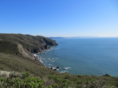
But that view is just a teaser of what is to come.  As you reach the top of the first uphill climb, the coast south towards San Francisco (and points even further south) comes into view.  Not positive, but I think you can see all the way to Montara and Pillar Point in the very far distance:


After descending down to Pirate's Cove, the trail then starts back uphill, and it pulls no punches.  Stairs - lots of them!:


Reaching the top again, SF and Ocean Beach come clearly into view:


Yep - the weather today was clear enough to see the Farallons, even more distinct today than a few days ago:


The trail then descends steeply down to Tennessee Valley and Tennessee Cove:


After making my way out to Tennessee Cove, I paused to enjoy lunch on the beach with a great view.  There used to be an arch joining these two areas of rock in the picture below, but it collapsed just a few weeks ago at the end of December:


Retracing my steps back up to the Coastal Trail and back to Muir Beach, this time the non-stop views are north towards Point Reyes: 


Yes, of all the trails I've done in the Bay Area over the years, this is definitely one of my all-time favorites.  Can't believe how lucky I was to get to experience it again on such an incredible day!  It was so sunny and warm that I even got my first sunburn of the season.  Good to get my "hiker's tan" off to an early start this year.  :-)

Sunday, February 10, 2013

Day 21 - Alamere Falls, Point Reyes National Seashore

Today's hike: Coast Trail to Alamere Falls, Point Reyes National Seashore
Distance: 8.4 miles
Elevation gain: 550'
Thoughts:  Exceptionally scenic out-and-back hike which is rewarded with a waterfall right onto the beach

We're entering a streak of beautiful days here in the Bay Area, so on a (somewhat) warm and clear Sunday I decided it was high time to make the trek up to Point Reyes National Seashore to enjoy a hike before it gets fogged in for the summer.  This particular hike came on a recent recommendation from CS, who told me it's one of his personal favorites and a hike he does every year.  With that kind of endorsement, how could I resist?

It's been nearly a decade since I last ventured up to Point Reyes.  Located about 30 miles north of San Francisco it's a long, windy drive up the PCH to get there so it makes for a long day, but each time I've ventured up there my love for this gem is renewed.  The trail to Alamere Falls is located on the southern part of Point Reyes, and it hugs the coast for the first 1-1/2 to 2 miles before turning inland to pass by two lakes before emerging at the beach at Alamere Creek above the falls.

Here is a view of the coast along the hike:    


After we turned inland, we encountered this fun obstacle across the trail:

"I'll hold this massive tree up while you scramble underneath.  Hurry up - it's heavy!"


Pic of Alamere Creek just before it tumbles over the top of the falls:


Top of Alamere Falls:


Alamere Falls from the beach.  It took a death-defying (and unsanctioned) climb down the cliffs to get this view:


Ever had oysters from Drake's Bay?  They come from this area.  This is Drake's Bay looking northwest towards more of Point Reyes:


After enjoying lunch on the beach, we clamored our way back up the cliff and hiked back to the car.  On the drive home we were treated to incredible views of the Marin Coast along Highway 1, with SF and Sutro Tower in the background:


Point Reyes, I <3 you.  With your 100+ square miles to explore, we would be BFF's if you were just a little bit closer to me.    

Today marks the end of week number three, and this week I logged a total of 28.75 miles and 8,295 ft of elevation gain.  I still want to continue working on the elevation training with some steeper trails, but overall I'm feeling pretty darn good.

Friday, February 8, 2013

Day 19 - Settling in, plus Mission Peak

Today's hike:  Mission Peak
Length: 6.6 miles
Elevation gain: ~2,200'
Thoughts: Steep and relentless.  And watch your step - that's not mud!

Now that I am on week #3 of my sabbatical, I'm finally starting to settle into it.  Ever see people running errands during the middle of the day and think to yourself, "Don't they have a job or something better to do?"  Yeah - I'm proud to say I've become one of those people.  I have to set an alarm if I want to be out of bed any time before 9am.  I find I'm watching Kathie Lee and Hoda on the fourth hour of "The Today Show" far too often.  Best of all, I'm starting to lose track of which day of the week it is.  Every day is like a weekend day, and it is spectacular!

I'm also enjoying the ability to be one of those "ladies who lunch."  OK, while I may never officially wear that badge comfortably, yesterday I enjoyed a free lunch with a friend and former colleague who now works at Twitter, and got to check out how the young, hip, cool people roll.  My thoughts on the Twitter cafeteria?  #f'ingdelicious  #somuchyummyfreefood  #dontknowhowyoustaythinworkingthere  #freebulkcandyalldayrocks.  Thanks so much for the free lunch, SE!  #letsdoitagainsoon

This week I also hit the metaphorical brick wall on my hiking/training regime and for most of the week found it difficult to motivate myself to explore new hiking locations, relying instead on some oldies-but-goodies or the gym.  Yes, I got some mileage in and logged a total of 8.5 miles and 1,844 ft of elevation over the past few days, but not by doing anything particularly interesting.

I did get motivated to head back into the kitchen and try out another recipe out on K.  This time I decided to try a recipe out of one of my cookbooks - homemade pasta sauce with Italian sausage and chicken, and of course plenty of wine.  K consumed every speck on his plate, so I'll take that as a sign that he liked it.  :-)

So after a lazy week filled with good food, today I finally found the motivation to get my butt back on the hiking trail and made my way over to Fremont to check out Mission Peak.  Yes, that's right - the Peninsula snob in me voluntarily drove to the East Bay for something.  Can you believe it??  Those who know me well are probably shocked at this one, because they know I don't go the East Bay for much of anything if it doesn't involve booze, a fabulous meal, or a spa treatment.  Well, we finally found an exception.  This was a trail that K recommended a few weeks ago as a pretty steep trail so good for some elevation training, and he was right.  This trail is about 3 miles of constant, relentless uphill.  Definitely a good workout.  Here's a view of the hill (I'm headed toward the highest peak in the pic):  


Lots of happy cows from California on this trail.  I even had to cross a couple of cattle guards.  And most importantly, had to watch every step I took.  Even after a good rain, on this trail what looks like mud is much more likely to be a cow pie.  Here's a sight you don't see every day - cows with Milpitas and San Jose in the background:   


At the top, there is a cool monument with sight scopes - each looks through to a landmark in the Bay Area (Mt. Diablo, Mt. Tam, SF, Dumbarton Bridge, Lick Observatory, etc.)


Panorama from the top of the Bay towards SF, the Peninsula, and the South Bay:


It was downright frigid at the top even after the grueling uphill hike, so I didn't linger very long before making the descent.  As I started to make my way down, a hang glider took off below me, so for a time I was actually hiking above him.  How cool is that?  Overall this was a good hike, but one which I definitely felt in my hips, legs and knees afterwards.  It convinced me that it is time to buy some hiking poles.  REI, here I come!

Monday, February 4, 2013

Day 15 - Elevation day. Treadmill, 15% grade, 5 miles, GO!

Today's "hike":  Treadmill
Length: 5.25 miles
Elevation gain: 3,701'
Thoughts:  Mile 3.5 - 4.5 was painful, but I'm almost there.  I can do this.

Highlights of Superbowl XLVII for me?  3) Since both John and Jim Harbaugh went to my high school and have strong Michigan ties, the "Harbaugh Bowl" was pretty cool;  2) Finally getting the chance at some "Kaepernicking" during the second half (wasn't looking like we'd be doing any after the first half); and 1) Beyonce and D-Child absolutely rocked that halftime show and really turned the lights out on the place.  :-)

After taking a day off to enjoy the Superbowl, today was a pre-scripted elevation gain training day.  I wanted to make sure I made an honest effort to replicate the 5 mile/4,000' gain day which is coming my way in a few weeks, so that meant heading to the gym.  After working my way up to a 15% grade gradually over the first mile, I came pretty darn close (the last 1/4 mile was a cool down with 0% grade).  Now all I have to do is keep working at it and get the grade up just a bit more.  But at least now I know roughly what this day is going to take.  I'll try a few more trips to the gym, and when I get to Aspen I'll find a really steep hike as my final training hike before heading to NZ.

Saturday, February 2, 2013

Day 13 - The Presidio, Golden Gate National Recreation Area

Today's hike:  The Presidio/GGNRC - Bay Ridge Trail et al
Length: 8.25 miles
Elevation Gain: ????  definitely a little, maybe a couple hundred feet
Thoughts: An urban hike in SF's lesser-known urban oasis, which boasts some the best views the City has to offer

The fantastic weather hung around for another day in SF, so it was an easy choice to meet up for an urban hike on a Saturday with some friends.  We decided to grab brunch/lunch on the south side of the Presidio before exploring this former military base on the northern-most tip of the city.  With no particular route in mind, we set out to explore this lesser-known park in SF on a route that would eventually take us all the way through the Presidio to Crissy Field, Fort Point and the GGB, and around to the western side of the Presidio with views of the Golden Gate and the Pacific.  Along the way we discovered some new views and unknown places which none of us had explored in the 10+ years we've lived here, including:

Inspiration Point in the Presidio:


The San Francisco National Cemetery, one of the most beautiful final resting places for those who served our country (closed to new internments in the 1990's):


The Presidio Pet Cemetery: 


View of the GGB from Fort Point at Crissy Field (if you ever visit SF, don't miss Fort Point - its a really fun place to explore):


View of the Golden Gate from Immigrant Point Overlook:


The hike also included some meandering through the Presidio Golf Course and around a lake none of us knew existed, so it was truly a day to learn and explore.  As always with my friends, the hike ended with food, booze and lots of laughter.  So fun to explore new places in the city where we live!

With the 49ers playing in the Superbowl tomorrow, its safe to say tomorrow will be a day off to enjoy the game and celebrate.  That means I've logged just a little over 27.5 miles and roughly 4,000' this week.  Not bad for a week when I came down with a cold and felt a bit run down as a result, but I definitely need to amp up the hikes with elevation gain next week.    


Friday, February 1, 2013

Day 12 - Golden Gate National Recreation Area/Rodeo Beach

Today's hike:  Golden Gate NRA - Coastal Trail and Hill 88 Loop
Length: 5.5 miles
Elevation gain: 1,000'
Thoughts: A glorious hike on a glorious day!  Does it get any better than this?

Every now and then I have those moments when I am reminded how very lucky I am to live in the SF Bay area.  Today was definitely one of those days.  This was one of those "chamber of commerce" days when it was 70 degrees with beautifully clear blue skies on Feb 1.  And even though I'm fighting a cold which is zapping most of my energy and kept me sidelined for most of Day 11 yesterday, I felt the need to get outside today and enjoy the sunny day with a beautiful hike.

On a clear day during winter in SF there is no better place to enjoy the sun than the Marin Headlands, just across the north side of the Golden Gate Bridge.  During the summer months this area is fogged in, cloudy, windy and very cold, but on warm days during the winter months it makes for some of the most incredible views in the world.  So on a day like today, I selected a hike where I could enjoy everything this area has to offer.  On my way to the hike, I had to stop and take this postcard-worthy shot.  It seriously does not get any better than this (download this picture and save it as your wallpaper - you can thank me later):


After enjoying the views of the GGB with all of the tourists, I finally made my way to the start of the hike.  I didn't realize it until I got to the parking lot, but I've done a portion of this hike before.  The hike begins at Rodeo Beach in the Golden Gate National Recreation Area, just north of the GGB.  The trail climbs very quickly with 1,000' of elevation gain over the first 2.3 miles.  There are a couple of old military batteries along the way, and the views all the way up are absolutely incredible.  When you reach the top of Hill 88, here's the payoff:

South towards Rodeo Beach, SF, Baker Beach and the Golden Gate:


West towards the Pacific and the Farallon Islands (30 miles off the coast of SF), which you can just make out in the center of the screen (click the pic to enlarge - makes it easier to see 'em):


Northeast towards Mt. Tamalpais, Mill Valley and Napa/Sonoma in the far distance:


Northwest towards Point Reyes National Seashore, Tennessee Valley, and Mt. Tam:


After enjoying the views and a leisurely snack, I headed down the backside of Hill 88 and around the lagoon at Rodeo Beach.  Here's a nice shot of the beach, lagoon, and former military barracks at Fort Cronkhite:


Didn't plan it, but I hit the beach right at sunset.  What a fabulous ending to a great hike on an incredible day!